Cross-Field Collaborations Add New Value to Geographic Information
Geographic information systems (GIS)are intimately connected with our daily lives. Professor Wanglin Yan,whose work is in the vanguard of this field, discusses the wide arrayof everyday applications and the future potential of GIS.
YAN, Wanglin
ProfessorFaculty of Environment and Information Studies
What GIS Has Given Us
 My specialty is geographic informationscience, with a focus on geographic information systems (GIS). A GISis a system that maps information of various kinds onto location datain a computer system, making it possible to analyze, compare, andprocess the information in an integrated way. Although people tend tothink of this as a technical and abstruse subject, in fact GIS showsup in many roles in our everyday lives and has become an essentialtool in numerous fields. In public administration, for example, GIStechnology has dramatically improved management efficiency byenabling information on, say, fixed assets and street addresses to becollected in one place. In the business sector, it affords a kind ofaerial view of the market. And in the area most familiar to us all,there is a wealth of navigational uses. The best-known of these iscar GPS navigation systems. This was created by merging map data,satellite localization, and real-time traffic information. As theiconic application of GIS, it encompasses the cutting-edge technologyof this field.
The Four Ss of GIS
 GIS technology has largely developedsince the 1970s. The S stands for “system,” and, as thissuggests, GIS was originally conceived as a system to serve asdecision-making material, generally by layering information onto amap and analyzing it as an aid to problem-solving. Today, however,the S has taken on several further meanings. It can stand for“science,” in that one takes a scientific approach toinvestigating what the information means: given a certain area ofgreenery, one might use GIS to determine its makeup, what effects ithas, how long it has been there, and what will eventually happen toit. S can also stand for “service,” or making systems andresearch results available to the general public: think of how GPShas become part of our everyday lives in such handy forms as carnavigation devices or Google Earth. Alternatively, the S can standfor “society,” referring to the “advanced geospatialinformation society” (also known as “G-spatial society”). Thisis a society in which GPS-linked mobile phones are in common use,enabling anyone to come and go freely between geographic space andcyberspace without even thinking about the existence of positionaldata, and to take advantage of a wide array of applications, fromstreet safety and security to leisure uses. Thus, the acronym “GIS”has come to express four meanings in one.
The Value of Geographic Information
 I studied surveying at university inChina, then came to Japan for graduate studies in 1986. At that time,Japanese universities did not offer a specialization that coincidedexactly with my major, and so I entered the Surveying Laboratory ofthe University of Tokyo’s Department of Civil Engineering, whichoffered a closely related field of study. Researchers there took ascientific approach that linked civil engineering, economics, andgeographic information. To tell the truth, back when I was doingfieldwork and taking measurements as an undergraduate in China, Ihadn’t fully appreciated the value of the information and maps thatwe worked so hard to produce. Thus, it was exciting to see for myselfhow the University of Tokyo’s laboratory utilized geographicinformation for different purposes, such as assessing the economicimpact of public works and civil engineering projects and makingpolicy proposals. I thought, “Wow, geographic information can beput to truly meaningful use!” I realized that the information couldbe turned into more than mere figures, that you can generate addedvalue by incorporating the user’s viewpoint, and this gave me abroader outlook. Then, in 1993, I came to the Shonan Fujisawa Campus.I felt that a many-sided, interdisciplinary perspective was essentialto future research on geographical information, and therefore SFC’scommunity of cutting-edge researchers collaborating freely acrossfields was just the place for me.
The Approach to Environmental Problems
 My main focus is the environment. Butenvironmental issues pose a difficulty: in spite of their recognizedimportance to society, in Japan, where development has alreadypeaked, it is not clear what should be done in practice. And even ifone has a solution to offer, to gain its acceptance one must be ableto show how it will contribute new value to society. I approach thischallenge from a dual viewpoint: the “bird’s-eye view” providedby GIS and a “worm’s-eye view” that takes in environmentalvalues. A “bird’s-eye” or aerial viewpermits one to grasp the problem strategically, because one can takein a wide area as a whole. But when one flies over the problem, so tospeak, one often misses its essence. For that, one must come down toearth, investigate the problem in detail from a worm’s-eye point ofview, and find the solution that is right for the natural environmentand the people of that particular locality. Another way of expressing“bird’s-eye” and “worm’s-eye” is “top-down” and“bottom-up.” In the past, I think GIS tended to involve atop-down approach. In future—and this applies to all areas,including environmental issues—a bottom-up approach, or acombination of the two, will become increasingly important. I adoptthese two approaches in studying methods of sustainable development,both urban and regional. For instance, in studying Japan’ssatoyama, or traditional rural landscapes,
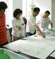
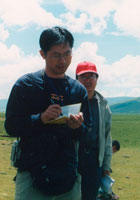
I provide members of alocal community with the on-line environment they need to utilize GISvia the Internet, and I ask them to enter ecological information suchas the location of woodlands, residential land, and paddy fields on acommon map. Turning this detailed information into a database foranalysis enables us to make a quantitative assessment of the value ofthat particular satoyama. The ability to analyze detailed informationobtained from local residents gives us a detailed picture of thespecial features of a satoyama area, and thus we can proposeconservation guidelines at a more specific level. Similarly, in aproject to combat desertification in the Horqin Sandy Land in China’sInner Mongolia region, and in a project that focuses on theQinghai-Tibetan plateau, we maintain both a global perspective andthe perspective of the local people. We propose and implementconcrete solutions to problems with the government, researchers, andNPOs working in unison. By pursuing this new approach, I hope todemonstrate the potential and the effectiveness of GIS.
The Future of GIS
 Traditionally, mapmaking has been, bynature, a national government undertaking. It has also been veryexpensive to produce digital maps and disseminate GIS. Consequently,it is only very recently that this field has acquired a solidinfrastructure, developed partly through government initiatives andpartly on a commercial basis. The question we face now in thegeographic information field is how to give added value to thosefoundations, or how to enhance the value of information. As I see it,in creating added value for geographic information, the viewpoint ofthe general user will become very important. Having a solidinfrastructure for geographic information in place and merging thiswith the Internet has made it possible to share data acrossdisciplines and national borders using common platforms. The rapiddevelopment of handy devices like mobile phones means that in today’senvironment the layperson can use GIS without having any technicalknowledge, and it is becoming increasingly popular. Thus, generalusers can upload large quantities of information to Internet-basedcommon platforms. They can gather information that interests them andcreate original, personal maps, and they can share these with theworld over the Internet. This shared information no longer representsthe viewpoints of government, businesses,
 and research institutionsalone, but contains inputs from the general public. What this meansis that people from all walks of life can cooperate on the samebasis, transcending the barriers between different fields. Ianticipate that all kinds of novel ideas and partnerships will emergeand map information will take on new added value. Currently, socialand environmental changes are bringing about far-reaching changes inthe way we behave and communicate. We have entered an era ofcollaboration among many actors—government, business, citizens,research institutions, and others—working together to give addedvalue to GIS and create new services. In September thegovernment-sponsored G-spatial EXPO will be held at PacificoYokohama. Our laboratory at SFC will be exhibiting at this event. TheExpo’s catchphrase is “‘When & Where’— InformationChanges Our Lives, Now and in the Future,” and many newtechnologies and services will be on display. The fourth S of GIS,the advanced geospatial information society or “G-spatial society,”is poised to enter a new phase.
A Brief Background of Professor
YAN, Wanglin
Professor Yan graduated from WuhanTechnical University of Surveying and Mapping, China, in 1982, andwent on to complete the master’s program at the School ofEngineering’s Department of Civil Engineering of the University ofTokyo in 1989. He also completed the doctorate program at the sameuniversity in 1992 and was awarded a PhD in engineering. In 1993, hebecame a research assistant at the Faculty of EnvironmentalInformation of Keio University. After holding a position as associateprofessor at Musashi Institute of Technology, he returned to KeioUniversity’s Faculty of Environmental Information in 2001 as anassociate professor, and was appointed professor in 2007. ProfessorYan’s specialties are geographic information science, the urban andregional environment, and sustainability science. His majorpublications include GIS no genri to ōyō (Principles andapplications of GIS) (Tokyo: Nikkagiren [JUSE Press], 2003), andKokusai kankyō kyōryoku no atarashii paradaimu (The new paradigm ininternational environmental cooperation) (Tokyo: Keio UniversityPress, 2008).
(16 August 2010)
Archive